Sagebrush & Summits: Week 2
The Tetons, Beartooths & Bighorns.
Day 8: Grand Teton to Yellowstone NP - 30 miles
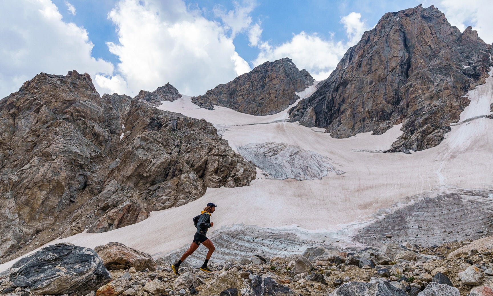
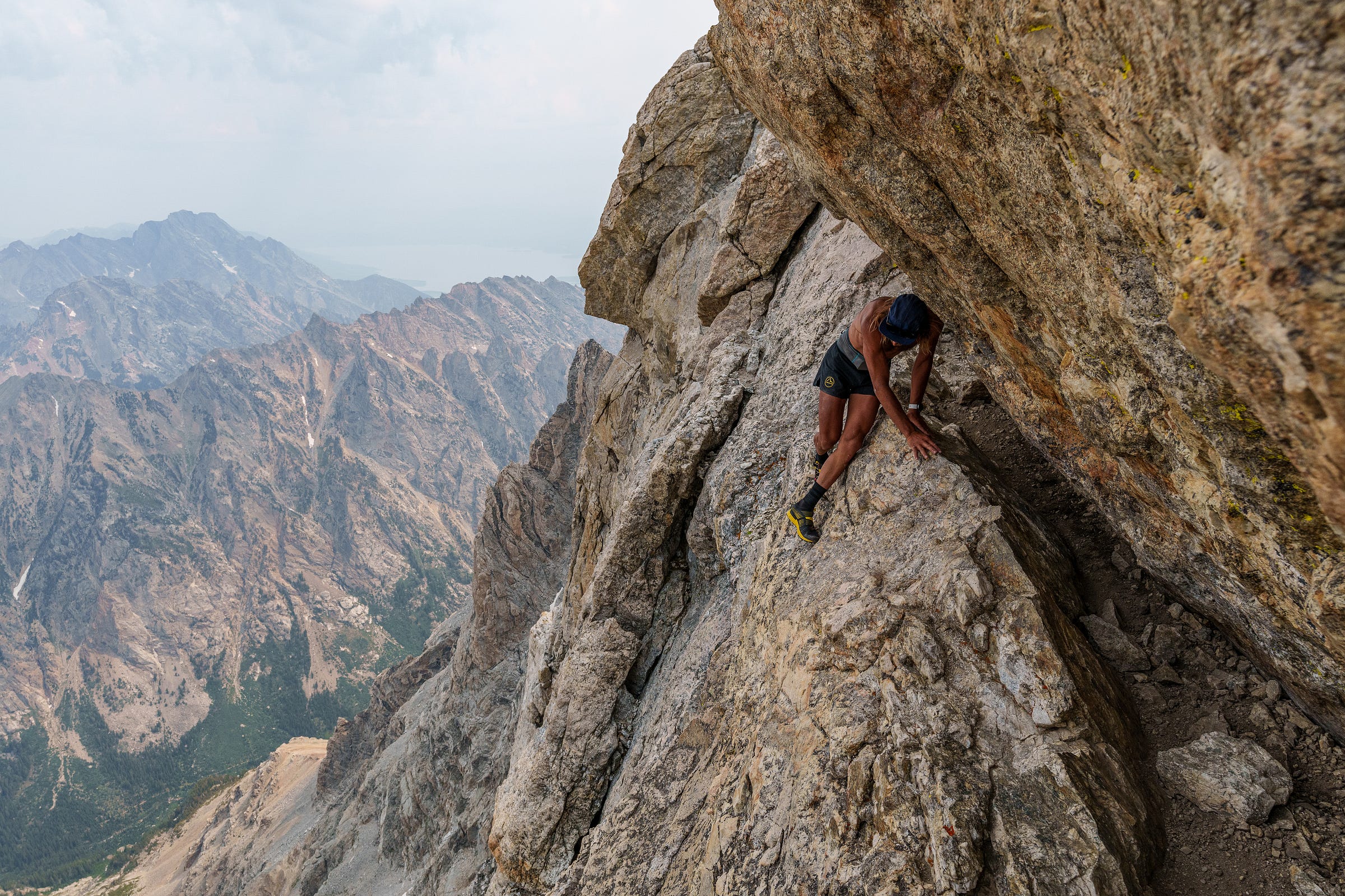
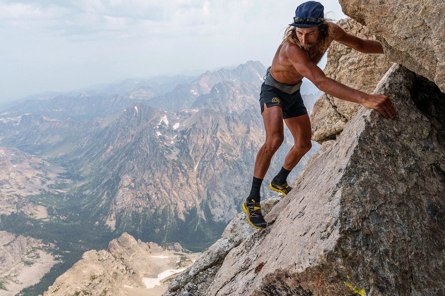
July 13, 2021: Fred and I jog across the jumbled and chundery Moraine on the approach to the Grand Teton. The Middle Teton’s towering east face—riven dramatically by a distinctive vertical black dike—blocks our view to the west. A view that we very much care about, considering it’s only 7:00am but the dark and turbulent skies have been rumbling and noncommittally spitting rain since the trailhead. I desperately hope to make the summit of the Grand, which still lies 4000’ above us, despite the vertical kilometer we’ve already ascended. I am exhausted. However, in spite of its renowned technicality—even the easiest route to the summit requires 5th class climbing with impressive exposure—this is the mountain on the whole trip of which I’m most familiar (excepting Longs Peak, in my backyard). The Grand is a comparatively short outing. At 15 miles roundtrip from the trailhead with 7500’ of vertical gain it’s a big day out by anyone’s standards, but I’ve stood on the summit a half dozen times previously. Unlike most of the mountains on this trip, it’s a known quantity, and that makes all the difference.
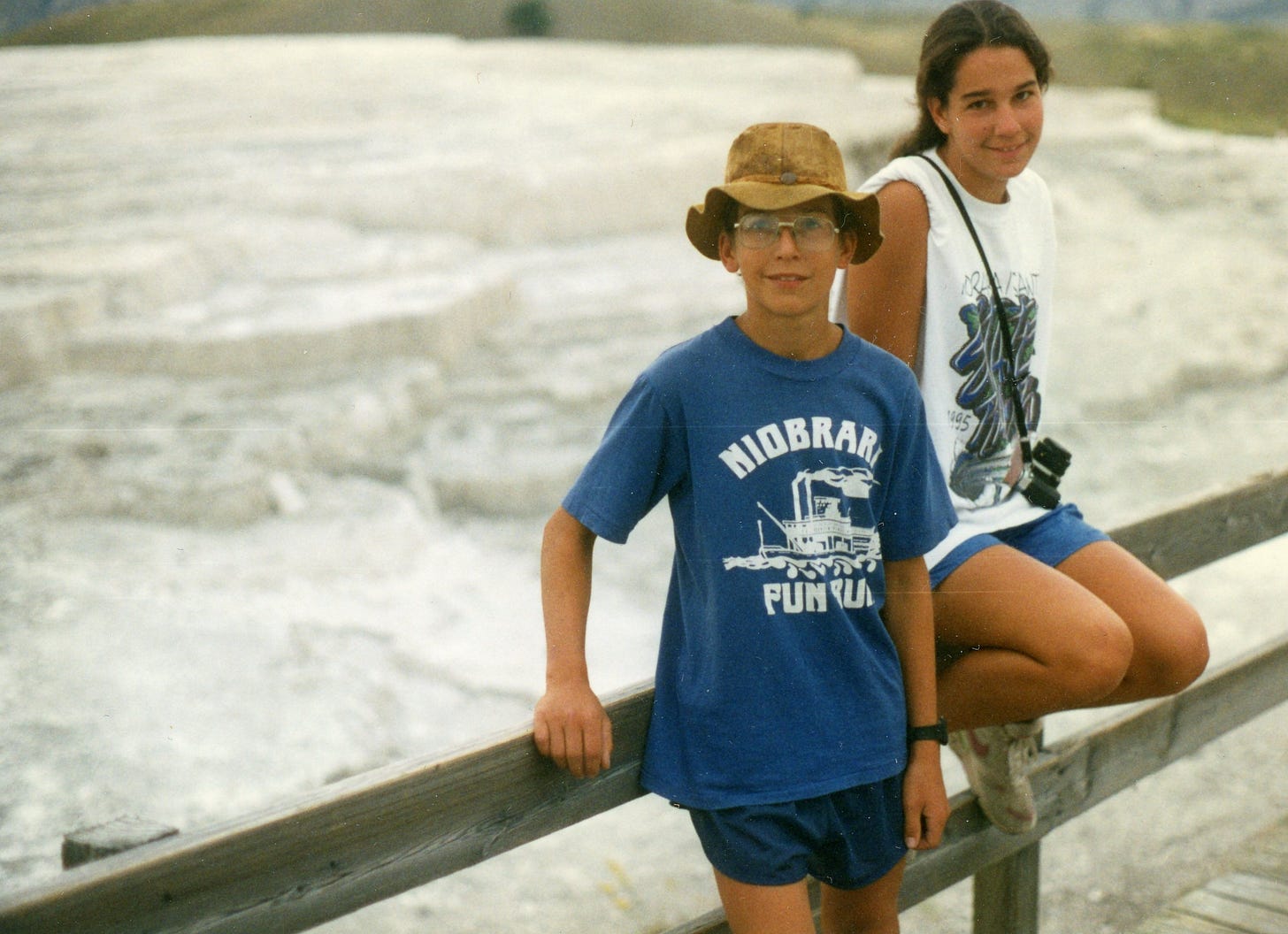
Furthermore, the Grand Teton has been a touchstone in my life as an outdoor enthusiast, and eventually, a professional athlete. I first became acquainted with the Teton Range on a hike up Paintbrush Canyon in the mid-’90s during a family car camping/hiking trip through the American West. We were Midwestern tourists on summer vacation, my parents trying to give their kids exposure to experiences beyond the grassy horizons of Nebraska’s Great Plains.
Even then I could tell the Tetons were different than, say, the Black Hills of South Dakota or even the similarly craggy peaks of Rocky Mountain National Park in Colorado. All that granite! A mile and a half of vertical relief! I remember seeing climbers—people with helmets, ropes and harnesses—and being able to vaguely sense that they were up to something exotic and adventurous. Even so, I’m not sure if it occurred to me that humans actually climbed and summited the sharp turrets that towered high overhead.
Ten years later, in July 2006, I was a runner, and after five years of college in Colorado, I was back in the Tetons. Running’s minimal barriers to entry—no eye-hand coordination involved, no equipment beyond a pair of shoes, able to be practiced basically anywhere—had lent itself to the Nebraska landscape and my meager athleticism and financial means, so it was the pursuit that I had poured myself into for the previous decade. Actually climbing the Grand Teton—or any of the lofty, craggy summits in the massif—was as much on my agenda as going to the moon, i.e. not at all. Instead, I was preoccupied with distance; a month later I would run my first Leadville Trail 100, which almost instantly triggered my career as a professional athlete.
In 2012—-five Leadville 100 Run’s later—I finally climbed the Grand for the first time, with ski mountaineer, alpinist and, yes, ultrarunner legend, Kilian Jornet, no less. My world of mountain movement had expanded drastically in the intervening six years. Now, in 2021, almost another decade on, I had since climbed all ten craggy peaks in the Grand Teton massif, and, despite the threatening weather, I know I have enough margin—in fitness and technical skill—to make the summit happen within the smallest of weather windows.
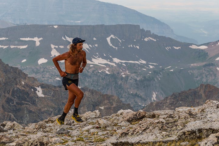

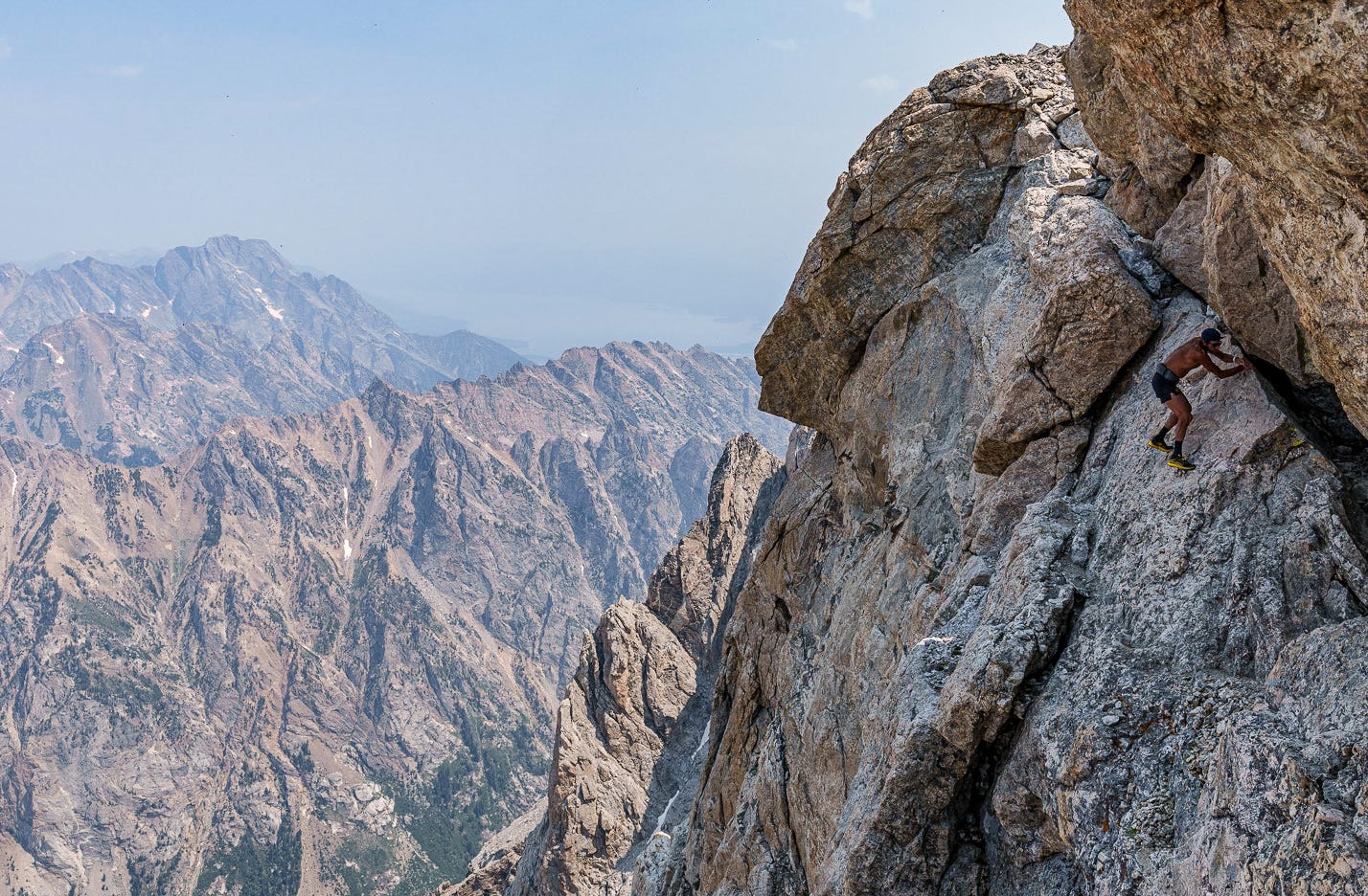
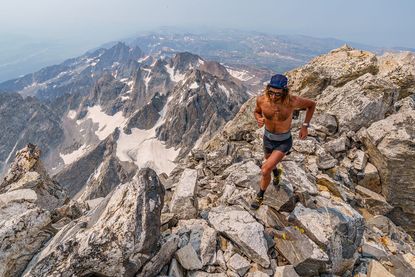
I leave Fred at the Exum Guides hut at the Lower Saddle, and in a lull in the rain and graupel scramble and climb the remaining 3000’ to the summit via the Owen-Spaulding chimneys, keeping an eye and ear to the sky the whole way, fearful of further lightning and precipitation. Having tagged the summit for myself, the skies, of course, clear up, and after downclimbing the OS, I actually huck another lap with Fred (a friend, but also an outdoor photographer), grabbing photos on the vertiginous terrain most specific to my sponsor La Sportiva’s mountain athlete marketing.
The run back down to my bike at the Lupine Meadows trailhead is a shambles—the clouds have cleared out, so now I’m baking in the alpine sun and the full weight of the previous week’s worth of mileage, heat and wildfire smoke seems to hit all at once.
After a quick dip in the lake, I spend the next several hours exhaustedly lounging on the Jenny Lake visitor center porch, crowds of Midwestern (and beyond) tourists swarming and wandering seemingly purposelessly around me as I try to nurse myself back to life with Coca Cola and potato chips. After tamping down some self-centered, self-righteous angst, it occurs to me how all those years ago I was one of those kids in one of those milling tourist families, just getting exposed to the Mountain West, and how a direct line could be drawn from that fledgling tourist experience to the trip I am now undertaking.
This realization calms me enough to take a brief nap in a quiet, cob-webbed corner of the deck before re-mounting my Evasion Lite and pedaling an obligatory 30 miles or so to a stealthy lakeside bivy just beyond the din of the ever-present National Park clamor and traffic. I find it to be a rare occurrence when I’m able to voluntarily effect a shift in my mindset from one of glowering negativity to expansive positivity. The fact that I’m able to do so in this instance—despite the heat and crowds and wildfire smoke—feels like a gift. I sleep well.
Day 9: Yellowstone to Cooke City, 155 miles
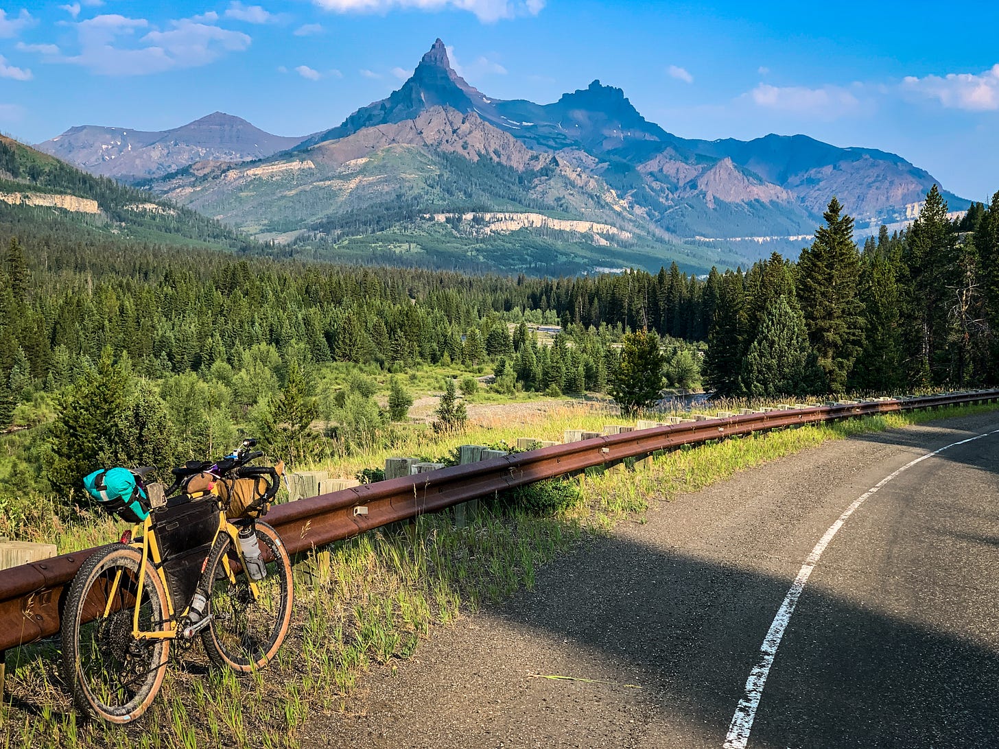
The National Parks of Teton and Yellowstone paradoxically present a real obstacle for the off-road cyclist. Bikes are almost universally not allowed off-road in the NPS, so cyclists are forced to take to the tarmac with the never-ending parade of tourist RV’s and trailers. There is also really no good way for me to get from the Grand Teton to Granite Peak in southern Montana without riding through these parks. The blanket 45 mph speed limit is the only saving grace. Shoulders on these tourist thoroughfares are desperately thin, but the heavy traffic and the law mean that almost nobody is speeding, or even in a hurry really. As a cyclotourist, one almost becomes another member of the wildlife community that it seems everyone is here to ogle.
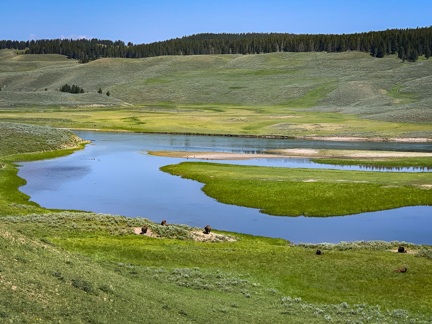
In great contrast to the previous day’s foot travel exhaustion on the Grand Teton, I have a magnificent day back aboard my bicycle. The frequent whiffs of sulfur emanating from the surrounding geothermal wonders mix with an unexpectedly grateful state of mind that has sprung from the nostalgia of those childhood car camping excursions with my parents and sisters. I surmount a slight rise in the terrain to be greeted with an open, luscious, montane meadow, replete with bison, elk and an idyllically meandering river. I feel like I’m pedaling through a museum diorama.
In the intervening 15 years since I’d last been to Yellowstone I had developed an irrationally negative view of this particular park. I was snobbish about its lack of a coherent, dramatic mountain range and its surplus of crowds. Why is it so popular? Well, on today’s bike ride I am rediscovering that there is undeniably something alluring about seeing the ground boil, blurp and erupt. The cognitive dissonance this provides—especially in such a scenic, seemingly unfettered setting—is a worthy attraction.
By midday, I’ve already covered 75 miles, but I realize that my planned route over Dunraven Pass is closed for road construction. I have no choice but to take the long way around—through the town of Gardiner and its Mammoth Hot Springs—adding an unexpected 35 miles of pedaling to my day if I want to still make it to Cooke City that evening. Fortunately, my mood is such that the detour doesn’t phase me.
In Gardiner, I pop into a convenience store for a soda and an ice cream sandwich. I’m hot and bonky with still some climby 40 miles to go. Enjoying my snack in the shade of the store, a middle-aged woman approaches for a chat. As anyone who has toured knows, a loaded bicycle seems to disarm people, breaking down the usual social barriers and inviting conversation. She and her family are on vacation from Iowa, and having passed me out on the road, are curious about my trip. Connecting with a fellow Midwesterner brings the previous day’s reminiscing about my own childhood road-trips full circle, and I pedal out of town charged with sugar and conviviality.
Late afternoon brings me to the legendary Lamar Valley in the northeastern quadrant of the park. What a place. I work my way through the scrum of auto-tourists here photographing the truly magnificent herds of bison and eventually bend north, climbing up the Soda Butte Creek drainage as dramatic peaks sprout up all around in the evening light—Thunderer, Baronette, and Abiathar all tower high overhead.
The tourists don’t seem to venture as far as this remote corner, so when I pass a few lone bison lumbering right down the middle of the road at dusk, I feel alone, vulnerable and nervous. These things are fucking giant. The size of a car. The vibes are distinctly prehistoric. The beasts effect no overtly menacing reaction as I meekly pedal by, but each time I am unavoidably confronted with my comparative insignificance in a wild world where the megafauna haven’t been pushed aside or eliminated. Humbling is the word, I think.
It’s just getting dark as I roll into Cooke City, and I’m thinking about bears. I quickly settle on a bivy under the back eave of the Visitor’s Center and let the day’s pedaling push me into a quick and deep slumber.
Day 10: Cooke City to East Rosebud Trailhead, 98 miles
The night before I had effectively skipped dinner. A desperate, just-before-closing dash into the general store in the village of Silver Gate at dusk netted me only a small cup of yogurt and a sleeve of almonds. Nowhere near the pile of calories I needed to cover the day’s efforts. Rolling around Cooke City’s main street—there’s no phone service to scan the town’s options—I had discovered the Bearclaw Bakery and the fact that it opened at 6am. Perfect.
I have been waiting the whole trip for the opportunity for a leisurely sit-down diner breakfast like this. Four chunky pieces of french toast lathered in syrup and butter, two eggs over easy, a couple strips of bacon, two double-Americanos and a pair of bonus pastries all feel like they barely make a dent in my appetite. The day’s riding is a relatively short 100 miles or so over Beartooth Pass, into the town of Red Lodge and then out to the East Rosebud Trailhead to set me up for the next day’s outing on Granite Peak, Montana’s high point. As such, indulging in a long breakfast fits my schedule nicely.
The miles out of Cooke City are slow. Uphill, tired legs, foggy brain. Intellectually, I know I am grinding my way up Beartooth Pass, but there is cement in my legs and not being familiar with the climb makes it feel endless. Eventually, I arrive at a roadside general store/gift shop and pull over amidst a crowd of Harley Davidsons to re-group. Some Coca-Cola, a poppyseed muffin, a bag of trail mix and a canned coffee serve as second breakfast. Despite the feast I’d enjoyed just a couple hours earlier my energy has been rock-bottom the last few miles; I can barely turn the cranks.
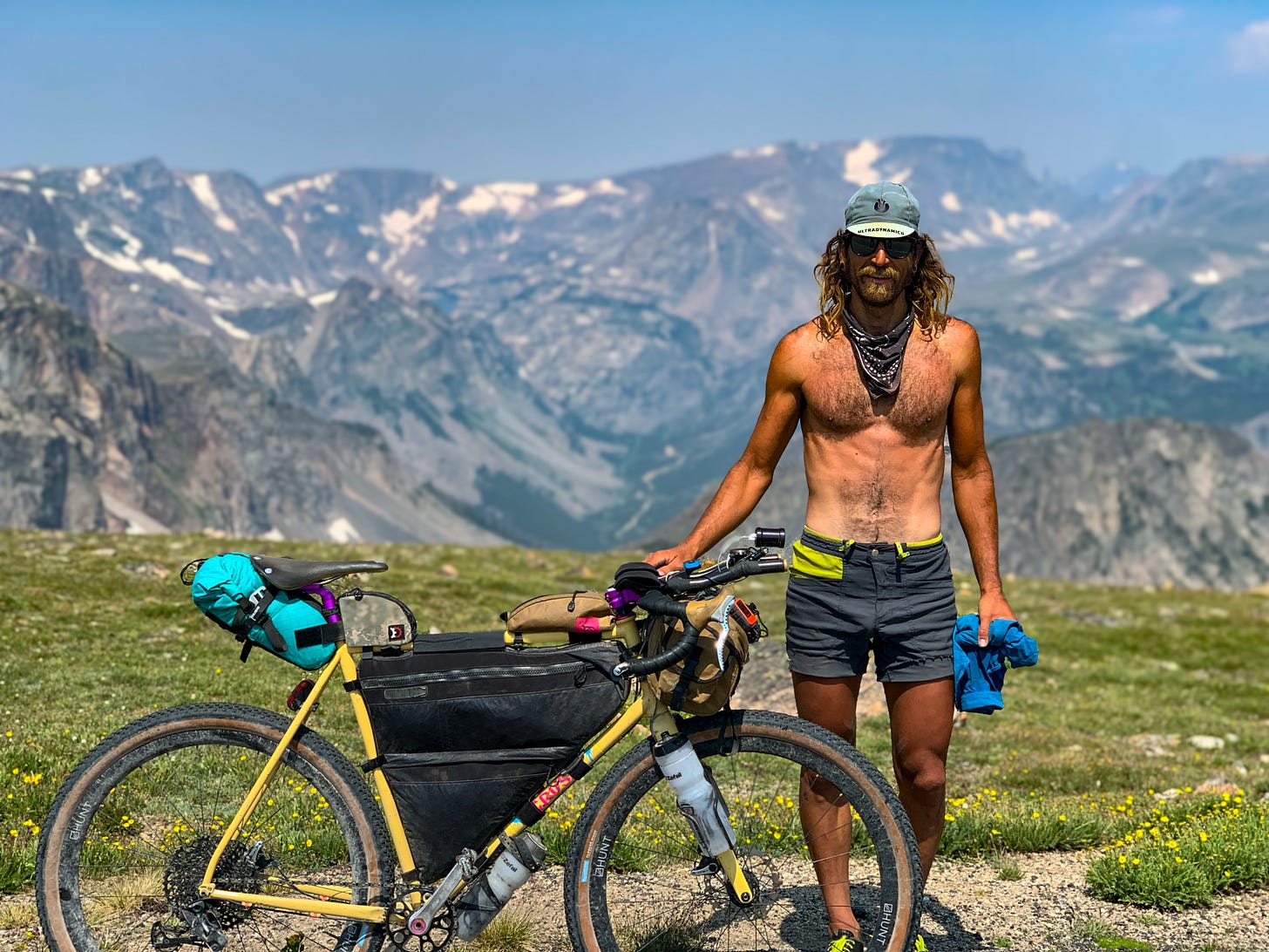
The extra round of calories and caffeine do the trick. The final push above treeline over Beartooth Pass is spectacular both in setting and in the way I feel. Just a couple days previous—chastened by my low energy on the Grand Teton—I had questioned whether it was even worth riding all the way up to Montana for Granite Peak. When psyche and motivation are at a low ebb, the mind is apt to wander to irrational and disappointing places. Now, on the precipitous and seemingly endless descent off the pass into Red Lodge, I am convinced that it has been worth venturing this far north for the riding on Beartooth alone. Actually summiting Granite the next day will be a bonus.
Let’s talk about bears. I’ve spent a lot of time traveling, running and racing in Europe, and, without fail, wildlife–-bears specifically—are what Europeans are curious about when it comes to running in the American Mountain West. Do I ever see bears? How often? Am I scared of them? I suspect most of this has to do with megafauna of almost any type being a rarity—if not full-on extinct—in Western Europe. Unfamiliarity breeds fear.
I see bears all the time in Colorado, especially in early summer and late summer, when they’re most actively feeding either coming out of or going into hibernation. The thing is, Colorado’s bears are mostly black bears and mostly not very aggressive. At least in my 20 years of interacting with them. I almost never think about them.
When camping, I have never hung my food overnight separate from where I’m sleeping. I’m embarrassed to admit this—especially since doing so sure sounds like good, responsible practice—but I just can’t be bothered. In 20 years I’ve had exactly one negative incident with a bear—back in the 2000s at a collegiate cross-country pre-season training camp outside of Buena Vista, CO one night a bear tried to break into the U-Haul trailer that housed all of the team’s food. That’s it.
Conversely, my older sister, Katrina, has lived for the past 20 years in southern Montana and northern Wyoming. Grizzly country. Grizzlies are notoriously aggressive. On this trip, Katrina recommended I buy a can of bear spray and carry it for the middle week I’d be riding, running and sleeping in grizzly country. I demurred, mostly out of procrastination and laziness.
But bears have been on my mind since I arrived in the Tetons. In Yellowstone, an entire flat of Fig Newtons had disappeared overnight—somebody or something ran off with them in my sleep without me waking. In Cooke City, I felt—perhaps unwarrantedly—safe because I slept more or less in the middle of town. But now, in the Beartooth Mountains, I am getting nervous for my trailhead bivy at East Rosebud Creek and for the ~15 miles or so of below-treeline backcountry running that my route up and down Granite Peak will require (in addition to another 10 miles above treeline in the middle of the day—it’s not exactly bear habitat up on the tundra of Froze-to-Death Plateau).
I feel slightly sheepish about the simmering, background level of anxiety I have about grizzlies but also like I’m somehow fucking up by not taking more proactive measures. The shame is rooted in my lack of experience in grizzly country and a feeling that as a professed mountain person I should have way more experience. I can’t tell whether—if I were more familiar—I should be less concerned or more concerned about grizzlies. The uncertainty leads to my not taking any meaningful action around the issue and just muddling through, with fingers crossed.
The potential for grizzly attack feels a little bit to me like making decisions about avalanche conditions in backcountry skiing. Every time I ski tour in the backcountry and I don’t trigger an avalanche the potential is there for confirmation bias about my decision to ski. The problem is that we can’t logically prove a negative. Just because the slope didn’t slide doesn’t necessarily mean that it was stable and safe to ski. It not sliding could very well just mean that we got away with something. That we were lucky. But as these non-calamitous experiences stack up, it can become easy to develop an inherent overestimation of our knowledge about how the snowpack is behaving in any given scenario.
Similarly, every time I go into the backcountry—especially in grizzly country—and I don’t see a bear and/or I don’t have a negative interaction with a bear, that doesn’t mean that the potential for same is insignificant, I don’t think. It just means that I got lucky. Every time a bear doesn’t raid the food bag, hanging the food bag seems increasingly unnecessary. Yet humans trigger avalanches all the time—to devastating consequence—and bear attacks definitely do occur.
In fact, my mood is undoubtedly heightened on this trip by a disturbingly recent incident. Only a week earlier, a cyclist on the Great Divide Mountain Bike Route a bit further north in Montana was killed in her sleep—she was camping in the middle of town, no less—by a marauding grizzly.
All of this weighs heavily on me as I prepare to pedal the 35 miles from Red Lodge out to the East Rosebud trailhead. While buying groceries at the local Safeway, gathering dark clouds unleash a violent downpour—the only significant precipitation of the entire three weeks—and after paying for my frozen burritos and trail mix, I call Hailey while I wait for the storm to pass. I’m tired, and the specter of sleeping alone in bear country that evening has my psyche at a low ebb, feeling lonely and prey to procrastination.
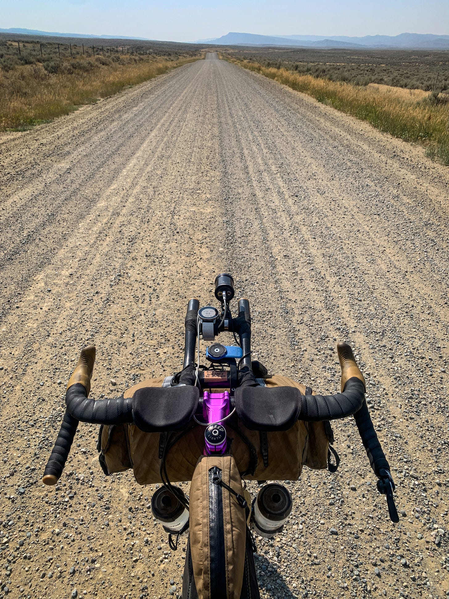
A couple hours later, as I turn south and head straight towards the Beartooth Range on a loose, false flat gravel road, my spirits are boosted by the unexpected beauty of the drainage I am pedaling up. High peaks still shrouded in misty remnant storm clouds tower over the valley floor, whose walls are lined with pinnacles of steep granite that look like prime climbing terrain.
In a hedge against bears, I roll an extra mile past the trailhead from which I’ll start my run the next morning and scope out a nearby Forest Service Campground. Maybe half the sites are occupied, and, crucially, there are metal bear boxes for storing food. I rationalize that it’s safer to not be sleeping alone. To my shame, however, I have only half of the $20 cash requested at the self-pay deposit box. I put my $10 in an envelope, pick out a comfy site, lock up my food and sleep like a baby.
Day 11: Granite Peak, Beartooth Mountains, Montana
I wake up feeling a thousand years old. The physical rigors of the trip are catching up to me. My tall milky can of coffee bolstered with extra sleeves of instant micro-grounds barely seems to register in my bloodstream. I’ve been abusing caffeine on this trip with wanton disregard.
As such, it takes me a full two hours from waking before I’ve packed up, stashed my bike in the bushes, and am ready to start running, a bit after 7:30am. The alpine July sun already feels hot.
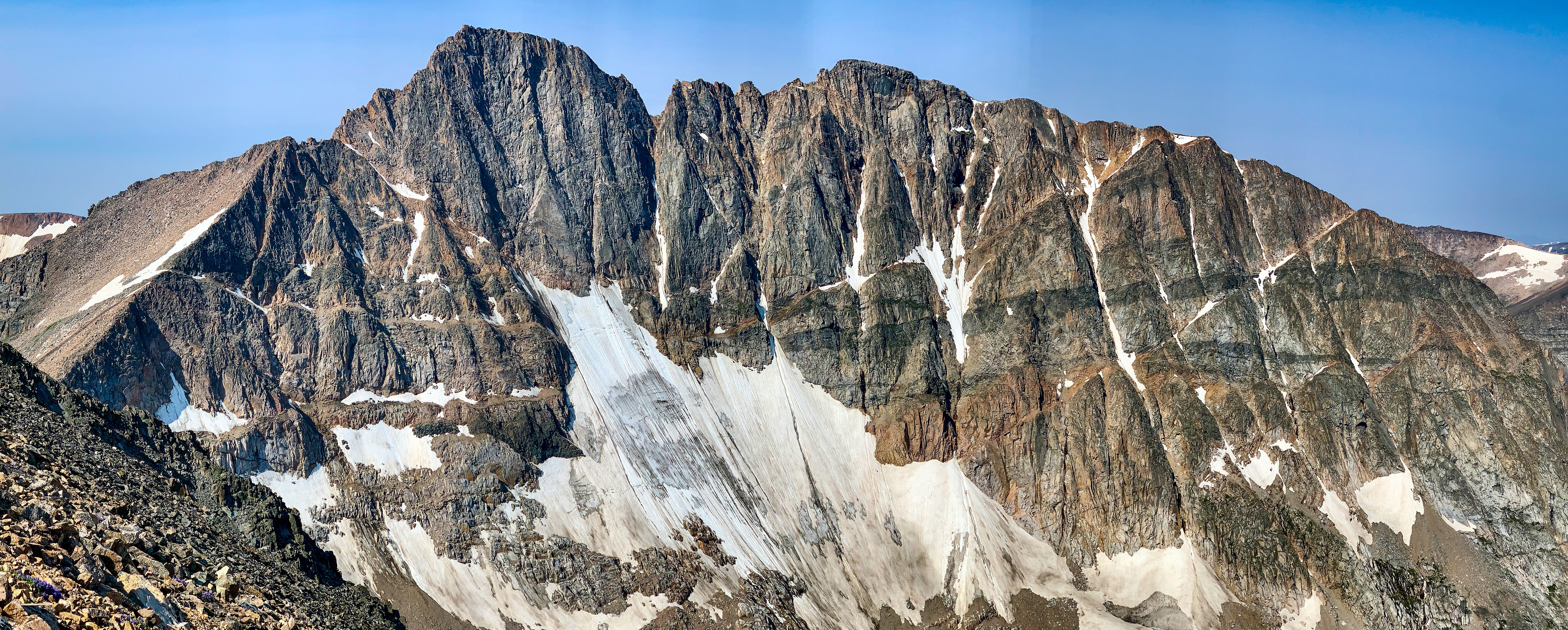
Because of its technical scrambling and remote location, 12,807’ Granite Peak is touted as one of the most difficult state high points—maybe the most difficult in the Lower 48, right up there with Wyoming’s Gannett and Washington’s Mt. Rainier. Granite is the most unknown mountain for me coming into this trip. Picking between the East Rosebud, West Rosebud and Aero Lakes approaches seemed confusing. The consistent thing was that each route was long—25-26 miles no matter what—with a lot of off-trail travel. I ultimately chose East Rosebud because it was the closest access to the town of Red Lodge—10 miles closer than the perhaps slightly more popular West Rosebud trailhead—and because the southerly Aero Lakes approach from Cooke City sounded complicated and with less precedent.
After a lovely 90min/4000’ approach run up Phantom Creek, the route gains Froze-to-Death Plateau—an above-treeline plain that spans approximately five miles and 2000’ of vertical gain across which efficient navigation is difficult. The footing is tricky talus, boulders and tundra and the lack of orienting landmarks makes it easy to wander onto an unnecessarily longer route . Also, it’s very exposed to any fast-developing weather systems. I have good energy in my legs, however, and the skies are clear, so I’m confident in being able to negotiate it without problems.
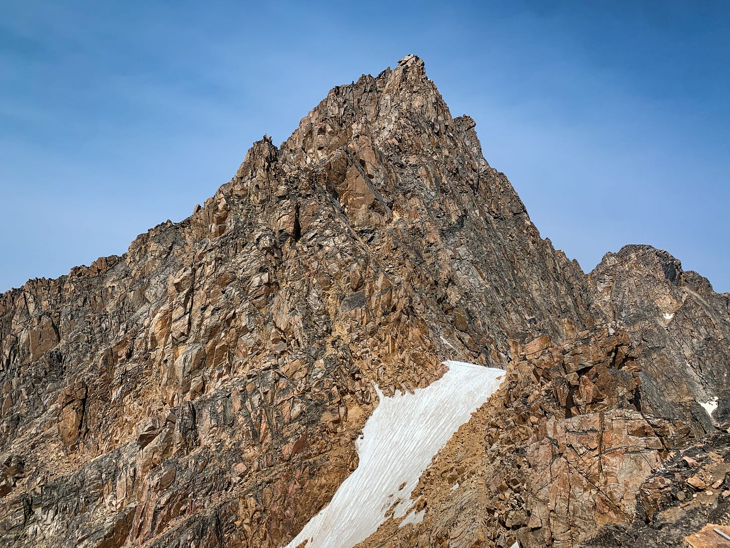
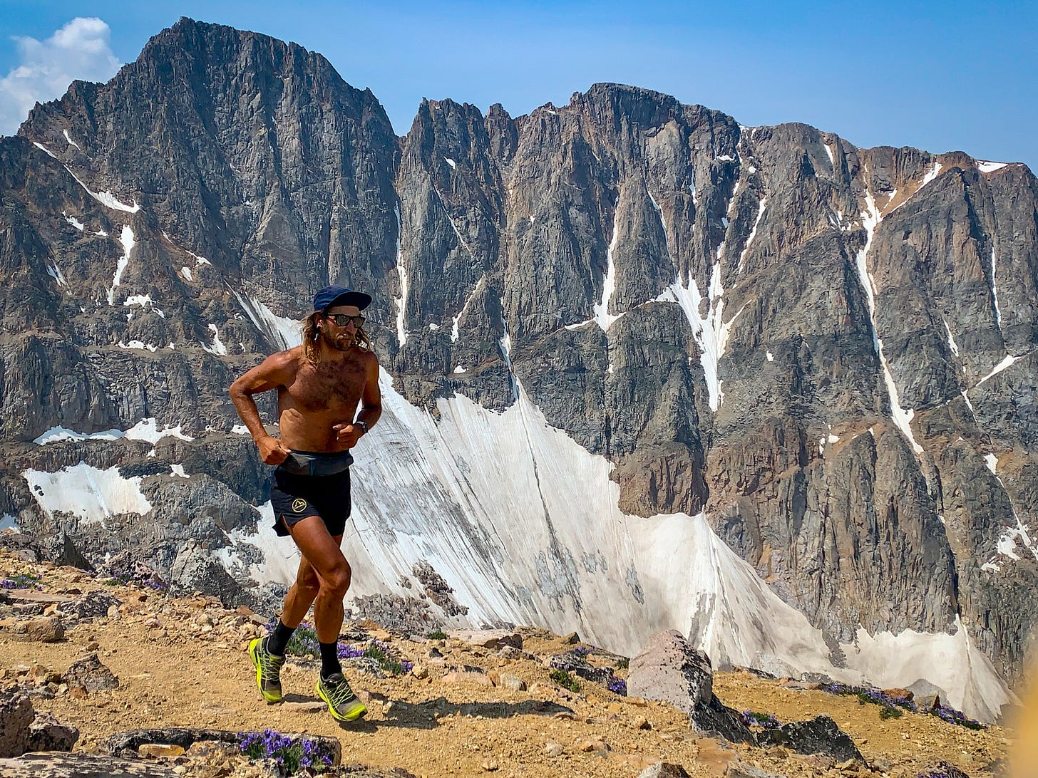
I pace myself across the plateau, cheating a bit by regularly consulting an offline map on my phone to make sure I’m taking as direct a line as possible to the final saddle below the summit of Granite itself. At this point—the shoulder of Tempest Mt.—I’m still confident in besting the ascent FKT of 3h24 from the East Rosebud TH, but the final few hundred feet of scrambling are complex and inobvious, making the easiest, most efficient route difficult to discern. I often stray into 5th-Class terrain, but eventually top out at 3:29:50. I pass a single party of two who are roped up for the technical pitches, but other than that I don’t see another human since the trailhead. This summit feels Out There. After 12 lazy minutes of taking photos, signing the register and eating some peach rings, I turn around and begin my journey back down to the valley.
The run down is an extended, lackadaisical bumble. I’m mostly motivated only by the thoughts of pizza and beer back in Red Lodge. The lack of effort I put into re-crossing Froze-to-Death Plateau, though, means that I have plenty of energy left for the final seven miles of trail down Phantom Creek, so I’m able to finish strongly, even in the midday heat.
Granite is an impressive and beautiful peak that doesn’t give up its grandeur easily. If it weren’t so deep in the backcountry and guarded by such a weather-exposed plateau I think it would be an instant classic for alpine rock climbing and general peakbagging. Unfortunately—or fortunately, depending on your perspective—it’s not easy to get back there. I think that’s okay, but I don’t see myself returning any time soon.
Twenty-five miles is a long run however you cut it, and after the 35 miles of mostly slow, loose gravel to get back to town I quickly scuttle any previous plans of riding still more that evening and instead treat myself to a giant pie and the only beer of the whole trip at the local pizza pub. There haven’t been very many soft evenings on this trip, but with a full belly and the easy shelter of the local baseball dugout, this is definitely one of them.
Day 12: Red Lodge to Basin, WY, 111 miles
A lingering breakfast at Red Lodge’s Cattail Bakery (highly recommend) delays my morning departure. By time I start pedaling up the small hill on the edge of town and enjoy the fast descent to the neighboring village of Belfry, it’s blazing hot. The night before in Red Lodge, a biker’s rally—the bikes of internal combustion and loud mufflers, not pedal—had overtaken the town; this morning, some of the revelry has spilled over into Belfry. I quickly scan town, looking for a spigot to top off my bottles before a long service-less stretch on the dusty and remote Silvertip Road. The only obvious option is a local saloon. It’s not even 10am, but the bikers are swarming the place, guzzling Buds and Millers. I’m more amused than annoyed and generally appreciate the mirth-filled atmosphere. The bartender—one of those weathered but cheery small-town types that calls everyone “hon” and you just know has seen some things—graciously fills my bottles and I tip her a couple bucks for the trouble. Off into the Bighorn Basin.
It’s so hot and exposed. The next three hours I just try to tuck into the aerobars and make good time. I get to Powell around midday, where I spend two full hours just hanging out in the grocery store, eating lunch and taking refuge in the air conditioning. When I finally leave, the heat is astounding. I’m back on pavement now, and it’s only 25 miles to the next town, but it’s a nerve-wracking couple of hours. At first there’s a small irrigation ditch I’m riding next to that allows me to periodically wet my cap and shirt in an attempt to stay cool, but eventually that disappears and it’s just me and the sun and the melting asphalt. I take a second to let a little air out of my tires—the last thing I need is to have one blow off the rim out here due to heated, expanding air. The vulnerability I feel in the blazing desert is profound and not something I had expected.
After another hour-long break in air conditioning in a general store in Burlington I venture back out into the now evening air. It’s almost 6pm now, so the sun is appreciably lower in the sky and the edge has been taken off my whole situation. It’s another couple hours of pedaling over to the town of Basin, where I retreat once again to the local baseball diamond dugout for sleep.
Day 13: Basin to West Tensleep Lake, 72 miles
I know that +100F temps are forecasted for the rest of the week, so I wake early, in the dark, and try to bank as many miles as possible before the sun gets too high. I stock up in Tensleep—known as a popular sport climbing destination and gateway to the Bighorns. I’d always just assumed it was more of a town. On this Sunday morning the only place open is the ubiquitous American convenience store/gas station.
Leaving town, I soon join a gravel road that marks the beginning of the 4000’ climb to West Tensleep Lake, trailhead for 13,166’ Cloud Peak, the highest mountain in the range. This road ascends at a mostly reasonable grade and winds its way beneath the limestone escarpment that I assume comprises the popular climbing.
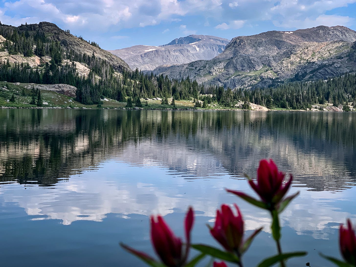
I arrive at the lake in mid-afternoon, hours before sunset. I’m happy to have ridden up to 9000’, out of the worst of the heat, and to have it be one of the lowest mileage days of the trip before trying to run hard on the mountain the next day.
The next few hours of rare down time soon turn into the absolute emotional nadir of the whole three weeks for me. At first I think I’ll go for a refreshing swim in the lake, but I can’t find an entry point where the water isn’t hiding seemingly bottomless mud. Then I think I’ll simply relax and journal on the shoreline—but the mosquitos are ubiquitous and relentless, never giving me more than a moment or two before I’m slapping them away. It’s still too hot to put on long pants and sleeves but I do so anyways as protection from the bugs. This doesn’t keep them from buzzing around my head, so I finally crawl into my bivy to escape. I’ve foolishly overlooked the need for a headnet or insect repellent on this trip.
It’s hot and windless. I’m abjectly miserable and quickly spiral into the worst headspace of the trip. I question what I’m doing out here and can’t believe I still have more than a week left. I briefly even consider skipping Cloud, packing up, and riding back down the hill to get a hotel room and begin pedaling straight back to Colorado, skipping the Wind River Range as well. It’s crazy where your mind will go sometimes if you let it. Instead, to pass the time, I resort to scrolling through the photos on my phone—anything to distract me from my negative thoughts, even though most of the pictures are compressed and low-resolution due to the lack of wifi or data.
Eventually, finally, mercifully, the sun gradually sets, the temperatures cool off a little, and I fall asleep, with absolutely no expectations for what the next day will bring.
Day 14: Cloud Peak to Worland, WY, 54 miles
I hold guarded hopes for challenging the FKT on Cloud. The FKT-holder is Aaron Robson, who the previous summer had also claimed the FKT on Gannett Peak, bettering my time by seven minutes. I figure that on a decent day I should be able to challenge his time on Cloud, even onsight.
The accumulated fatigue of the trip is hitting in a marked way, however, and I am not on a decent day. On yet another long, rolling, gradually uphill, backcountry approach I’m already six minutes off the pace after the first hour of running. It takes me so long to get warmed-up now. Upon crossing Paint Rock Creek, however, the terrain switches from idyllic, runnable singletrack through wildflower-strewn meadows to an off-trail uphill grind, scrambling across talus and boulders. I’m heartened to gain a couple of minutes back through here and reach the summit four minutes behind the FKT pace.
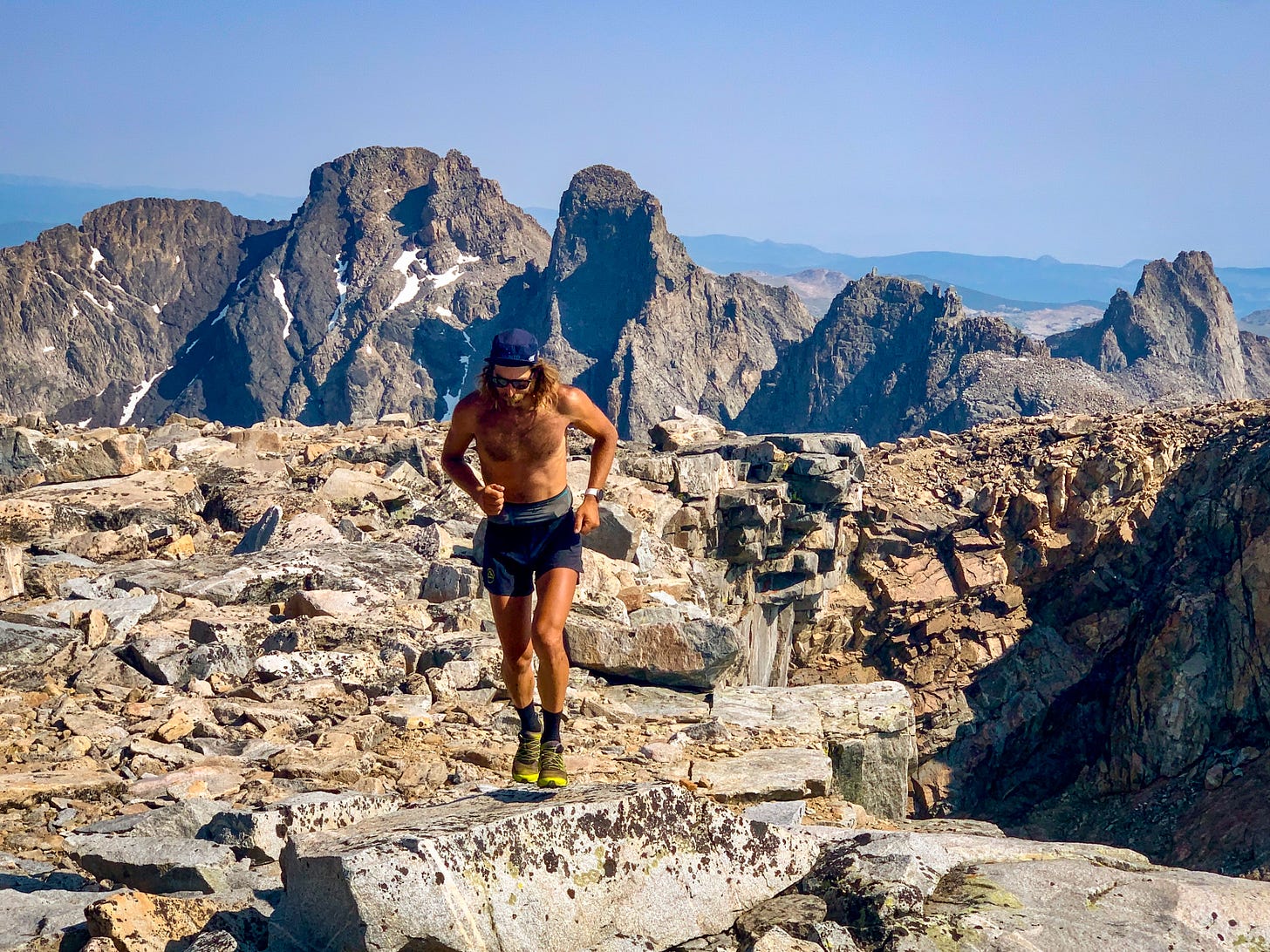
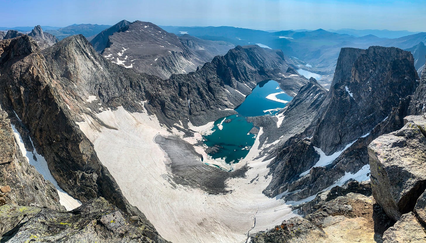
Once at the summit, though, any thought of immediately flipping around and blasting the descent goes away as I am distracted by the alpine splendor of Cloud’s glaciated eastern cirque and the dramatic alpine rock ridgeline of Mount Woolsey, the Merlon and Black Tooth. What a place! I suddenly feel silly for my narrow peakbagging mindset of running up to the highest point in the region when perhaps what I really should have been investigating was the alpine scrambling opportunities in this craggy zone just to the north. Alas, it is my first visit to the area and I would likely want a partner, rack and rope for any technical onsighting anyways. Being committed to the bike and going truly fast and light under my own power can have its limitations. All I can do is gaze at the alpine terrain and dream, and I do just that, resolving to one day return with a partner, until I start getting thirsty and am reminded that I should get going.
On the run back out the day is heating up, so I filter water many times and generally take it easy. Bombing the 25 miles down Tensleep Canyon on my bicycle feels like descending into a blast oven inferno. Temperatures soar to +105F in town that day and after my 23 mile morning of foot travel I spend much of the afternoon sheltered in air conditioning back at the Tensleep gas station before pedaling 30 miles to the next town over, Worland, trying to get a jump on my transfer west to the Wind River Range.
In Worland I’m exhausted from the heat and exasperated by the previous day’s psychological morass at the trailhead. My reward for not bailing on Cloud and my concession to committing to completing the rest of the trip is a $75 motel room. It has AC, a shower and a grocery store around the corner. After the past couple days, it all feels like the lap of luxury.




I’m a long time reader of your writing , all the way back to the original RTW blog. While I have enjoyed your Strava write ups since that went away, I am super pumped you are back to giving your rabid fans some long form content. And if you want to give Holos some real world feedback, I am at least one guy who bought the “oatmeal” they are paying you to eat 😎. Cheers and keep that beautiful prose flowing.
Really excited you came back to write more on the Sagebrush & Summits adventure. Honestly one of the coolest self-powered adventures I've ever heard of. I remember being totally engrossed in the Strava posts as you posted along the way. I actually read these first two Substack installments with the Strava posts for each day up on another screen. The geographer in me loves to have an eye on the topo maps while reading the narrative. Truly inspiring stuff man! Thanks for taking the time and effort to share!